The first mountain hike in Lapland
First day, Friday 1963-08-23
Abisko Tourist Station - Abiskojarestugan.
The original intention was that we would have visited both Narvik and Kiruna, but on the way up we changed our travel plans. Since we were traveling primarily to hike, Tomas thought we should also do that and leave Narvik and the mines for another time.
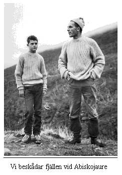
Therefore we got off the train in Abisko and started our little walk already that same afternoon. The distance to the cabin at Abiskojaure was only 15 km and we expected to get there before nightfall. After various inquiries at Abisko Tourist Station regarding routes and boat crossings on Stora Lulevatten, we were out on the Kungsleden. The route was very beautiful and varied to begin with. Sometimes perhaps too nice and easy, we would certainly experience that later. Over the worst places there were duckboards laid out, which was by no means the case in the continuation.
- Only if they have managed to lure the poor tourists far out into the wilderness are they left entirely to their own fate, said Tomas on a later occasion at a ford, when we would have needed a proper plank to cross.
The journey went first along the rushing Abiskojokk whose two tributaries Nissanjokk and Pallenjokk one crosses on bridges and later the journey goes along Lake Abiskojaure.
Upon reaching the lake we sat down and ate our first meal in the open. It wasn't much, we were going to cook real soup upon arrival, but a little chocolate perked us up and the journey could continue. There was some drizzle and we had a rainbow behind us for a long time, the evening sun peeking over the cloud edge broke through the drizzle and mist resulting in a magnificent rainbow. The terrain was fairly fine and even, real tourist terrain, and the journey went quickly.
About 2 km before reaching Abiskojaure, the trail meets a tractor road, Abisko-Sjangeli, which one follows partly along swampy ground on the eastern shore of Abiskojaure to the southern end of the lake. Over Kamajokk, the tributary of Abiskojaure, one crosses a suspension bridge and then has only 200 m left to the cabin, where we were at around seven o'clock. The entire route goes through Abisko National Park.
The tourist season was nearing its end and apart from the cabin host there was only a middle-aged German couple from Hannover. In the cabin there was a primus stove and we didn't need to take out our field stove, the denatured alcohol was to be saved for later occasions.
We cooked blueberry soup. It tasted excellent, after that it was time to take the bunks and rest after the first day's small stage to tomorrow with renewed strength be able to attack the Kungsleden on our hike through the magnificent mountain nature.
Second day, Saturday 1963-08-24
Abiskojaure - Alesjaure (21 km)
From Abiskojaure the journey continued, the first stretch is quite bare, relatively flat ground, but already after a few kilometers, after crossing the fast-flowing and foaming Siellajokk on a suspension bridge, the ascent begins. Immediately after the suspension bridge there is a very steep climb, it almost took our breath away, but we got up to the 700 m level, panting and breathless from the unfamiliar exertion.
To the left of the route lie the Keron cabins and nearby a herd of reindeer grazed, so the mountain idyll was complete. Here we left the birch forest, which we would not see for several days, only in Ladtjodalen would we encounter trees again.
From the 700 m level we had a fine view to the north and the birch forest. The journey continued over Tjåmohas and to the south we had a wide perspective over Alesvatten with the lakes and Kåtotjåkko in the foreground. From the pass it goes downhill on easy heath, soon to the east beyond Apparjaure opens the wide valley of Alesätno, which leads to Rautasjaure in the east. From there one continues along the sandy shores of Mesakjaure and Alesjaure (Vuolle and Paijeb Allesjaure), partly overgrown with low willow bushes. East of the lakes rise spurs from the Kåtotjåkko massif with glaciers, framed in deep niches. At the southern end of the lake, where Alesjokk flows in, lie the Alesjaure cabins. We had the Tjålemtåkko ridge on the right side and from it ran an endless number of streams, after a few days of rain the entire mountainside towards Vuolle Alesjaure and Pajeb Alesjaure consisted of one large swampy area, which we would have to force.
After just a few hundred meters, Tomas got his feet wet and his boots started chafing. We had to stop so he could change his boots for gym shoes and dry socks. After that we walked a bit higher up the slope, where the streams hadn't had time to spread out and where we could jump over them.
Shortly after we had passed a rather difficult and heavy marsh, Tomas discovered that he had lost his knitted cap. It had been tied to his backpack.
- Well it can't be further than there, he said, pointing to a small hill about 500 m from us. We had passed it a while ago.
What was I to do? I was tempted to send him himself to look for the cap, but realized then we would not get to Alesjaure during the day. I took off my backpack and made a quick march back. About halfway up the hill I found the cap and the journey could continue. At noon we sat down by a stream. It was drizzling so we couldn't stay too long, the view didn't invite any great experiences either, mist and fog lay over the entire valley. The ground was wet and we had to use the plastic sheets to avoid getting wet from below when we sat down. It wasn't rainy enough to need to take out the full rain gear.
After our 'quick lunch' consisting of mushroom soup, we could continue our journey in the mountain world. At around four we arrived at the Alesjaure cabins. The cabins were still empty, nor here was there any wood chopped or cleaning done by previous guests. They had been careless with hospitality and the obvious duties not to leave the cabin until the woodshed is filled and the cabin cleaned. Now it was for us to go out in the drizzle and start chopping wood. At such times you don't think nice thoughts about your fellow human beings, especially mountain hikers.
Towards evening the cabin filled to bursting point. People came from both Vistas, Sälka and Abiskojaure, soaked through, tired and hungry they all were and surely some were thinking that there would be no more mountain trips from now on, just to get back to civilization. As clothes dried and stomachs filled, the mood lightened and eventually it became quite cozy in the cabin. People discuss different routes, their pros and cons, difficulty levels etc.
Gradually the conversations quieten and the guests troop off one by one to lie down and rest up for the next day's hardships.
Third day. Sunday 1963-08-25.
Alesjaure - Sälka (22 km)
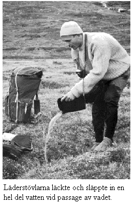
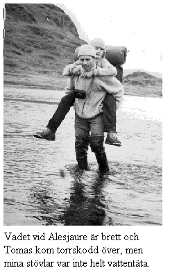
From the cabins in Alesjaure the journey went towards Sälka - a stretch of 22 km. The trail goes along the wide Alesvagge with its steep mountains with many glaciers, of which one particularly remembers Påsråtjokkojöklarna (1982 m above sea level). After a few kilometers one meets the first difficulty on this stretch, the ford over Allesjokk. At first we thought we would manage to cross relatively dry-shod, maybe I could carry Tomas over so he wouldn't get his feet wet. I walked a bit up the stream hoping to find an easier crossing place, but despite my efforts I couldn't find any better. The stream became more and more swift, I just had to turn back to the crossing marked out by STF and start wading. I went first and almost managed the whole ford, but the last bit could not be conquered, I got water over my boot shafts. On the other shore I put down my backpack, went back to get Tomas and carried him across.
Once across the ford it was just a matter of pulling off the boots, pouring out the water (at least 1 liter/boot) and putting on dry foot cloths. I didn't have any rubber boots but walked in my old military boots from the Finnish Army, the ones all soldiers got to keep upon demobilization. In connection with the ford we took the opportunity to take our first break and eat breakfast.
We found a good stone, behind it we could light our spirit stove. After a short break sheltered by the stone - sometimes large stones are needed because the wind is usually quite cold - it was time to continue our journey.
On the eastern side of Alesjokk begins the slow ascent towards the pass between Alesvagge and Tjäktjavagge. In stretches the trail goes over easy marshland. We passed a reindeer fence where some reindeer crowded and stared at us for a while before they set off at a trot with antlers proudly over their heads. After the fence begins a rather difficult terrain.
Quite late in the afternoon we arrived at the wind shelter and the last bit is steep and strenuous. We crossed a couple of small patches of snow and were up in the pass. At last! From the pass one has a breathtaking view: to the north the remarkable Alesvagge, to the south deep below the feet Tjäktjavagge, which one then follows for several miles, all the way to the Singi cabins and Unna Järta. In the wind shelter we cooked mushroom soup and rested for half an hour. We felt quite tired and thought for a while seriously about staying in the wind shelter overnight. But there was no wood to burn there and even though there were blankets so we wouldn't have frozen during the night, we decided, very reluctantly, to nevertheless set off to the next cabin. Otherwise we would have to get up very early the following day and it might be too long to walk to Kebnekaise on the same day.
Our backs and legs ached as soon as we got outside it started raining too, we had to put on our rain gear immediately. The descent from the wind shelter is steep for a couple of hundred meters, the ground was stony and slippery after all the rain and one certainly felt it in one's knees. The wind shelter is in the northern part of the Tjäktjavagge valley, on the wall that bounds the valley to the north.
Once down in Tjäktjavagge one has before one an easy mountain heath, where willow and dwarf birch occur sparingly. One walks past Suortjåkko and approaches Sälkatjåkko with its glacier. Walking through the valley one sees the pass for a long time, the 8 km to the Sälka cabins we could always see the wind shelter if one turned around and looked.
We walked and walked. The valley seemed endless, according to the map it was only about 8 km long. It was only at dusk that we finally saw the Sälka cabins, but we still had more than 1 km to go to them. The cabins lie between the two arms through which Räitajokk flows into Tjäktjajokk.
In the cabins there was already a lot of people. The cabin we were directed to by the cabin warden had two vacant beds, and the heat upstairs was (as usual) unbearable. One of the hikers was lying ill, he had been lying all day with fever, headache, and lack of appetite. It was now said, however, that he was somewhat better; he was sleeping. His companion was not quite well either, a short, stout man with at least 20 kg of excess weight already on his body and the rest piled on the bunk. Such a pack! How much it was in packed condition I don't know, but in "loose weight" the pack took up the entire bunk. Did he really need all that he had with him in the mountains? The entire bunk was filled with shoes (at least 2 extra pairs), pajamas, an electric razor with spare batteries, and a large quantity of canned goods. It was evident that he loved food, and there was no question of any Spartan life on freeze-dried provisions here. Later I heard that this enormous pack broke him; he became exhausted after a few days' stages and was transported to the Kebnekaise station by helicopter.
Most first-time hikers take far too many things with them. After a few mountain treks, one realizes that actually it is quite little that one needs. The backpack weight decreases significantly and the hike becomes much more pleasant when the backpack's shoulder straps don't press so hard on the shoulders. Backpacks have also become better over the years, more adapted to the human body.
Fourth day, Monday, 1963-08-26.
Sälkästugorna - Kebnekaise (27 km)
So as not to start too late, as was the case on Sunday, we started a bit earlier today. At 4:45 we left the cabins at Sälka and headed south. The weather was reasonably dry, but not entirely risk-free for rain. In the morning we had sun in some places; the long, grinding climb towards altitude 1010 m, which rounds Singitjåkko, had sun almost the entire time. On the pass it became cloudy and a cold wind began to blow. The trail continues east through the desolate, beautiful Ladjovagge, which is bordered to the south by Liddopakte, on whose vertical, dark, grooved mountain walls the shadows always play, often accompanied by vast scree slopes. The upper part of Ladtjodalen is very rocky, but despite this, easy to walk.
Through Tjäktjavagge the path goes for the most part over easy terrain. On the stretch nearest south of the Sälka cabins, one sees in the north-easterly direction the Påssestjåkko and Selmatjåkko massifs. Nallo, on the other hand, was hidden by the spurs of Knivkam. After crossing Kaskasjokk, the peaks of Sälkatjåkko appear in the north-westerly direction, and in the north-east lies the jagged Nipals at the far end of Kaskasavagge.
The straight Tjäktjavagge cuts across some of our mightiest mountains. Numerous valleys empty into it, all with rushing streams fed by glaciers from the high mountains. Most of the streams are so divided that one can easily wade across them. The most beautiful valleys come from the east, from Räitatjåkko, Kaskasatjåkko and Kebnekaise.
The third and fourth day's muscle pain began to set in, and Tomas complained quite a lot that the backpack didn't sit right: the straps pulled and there was nothing that worked. All my attempts to explain that it could be the body's reaction to fatigue were stranded on his rock-solid assertions that everything was the backpack's fault and nothing else.
At a snail's pace we nonetheless got up to the pass and were fortunate enough to also find a sheltered spot where we could cook our lunch soup and rest a bit. Behind a rock we could light the spirit stove, but despite shelter from boulders and backpacks, gusts of wind still came now and then; we had to refill the stove three times before the soup was cooked. For lunch guest we had a lemming, a real "tourist lemming"; it didn't seem shy, and one could almost believe it was tame. It came forward several times and begged for a piece of macaroni and sausage.
The clouds were low, so we couldn't always enjoy the mighty Signetjåkko view; it lay northeast of the trail. The journey through Ladtjovagge was not particularly fast; it had started raining again and the path was slippery and slick. No matter how we looked, we could not see the tourist station. The branched stream from Singivagge we could easily wade across, as well as Kittelbäcken. The cairn route continued, and soon we were at Jökelbäcken. Now only the steep but short slope of a mountain ridge protruding from Kebnetjåkko remained; then we glimpsed the mountain station and were there after a few minutes.
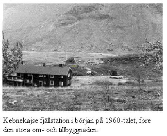
Every now and then we heard helicopter sounds and saw the helicopter flying between the mountain cliffs. The Ranger School had its autumn march set in the area, and the battalion was to hold its service on Kebnekaise's south summit on Monday morning. At the tourist station we were assigned a kåta (Sami hut) and after unpacking our things, we ordered a dinner. Tomas wanted nothing to do with cooking soup ourselves; he was already tired of that.
The tourist hotel served salted reindeer meat with mashed potatoes. We ate easily double portions (if not more) of both, and we could barely walk from the table afterwards. After coffee and a little chat with some other hikers, we went to our kåta. It was a six-bed kåta, and in it before us were a young Danish couple, students from Copenhagen, and a couple of Swedish boys from Stockholm.
It had rained quite a bit in the afternoon and it was still raining. The kåta began to leak, and my sleep was not long; I dreamed that we were still wading across Alesjokk when I woke up feeling my feet wet. It dripped from the roof, but luckily such that we could move the mattresses aside a bit so the drops fell on the floor. The bunks were not particularly good, in the style of old tourist beds, so there was a creak whenever someone turned in their sleep, but a kåta is not a luxury hotel either, so we couldn't complain to the manager. On the other hand, the price—2 kronor—was nothing to complain about; one appreciates an old Sami kåta after all when one wants to sleep indoors.
Sixth day, Wednesday, 1963-08-28.
Kebnekaise - Kaitumjaure. 26 km
The weather was not such that we could go up to the summit of Kebnekaise. We decided instead to continue our journey further to Kaitumjaure. The weather was not particularly cloudy, but we got a rain shower on us anyway; during the descent from Unna Järta (Lappish for "Young Hearts") we had to put on our rain gear. The crossing of the widely branched stream from Singivagge had swollen, so we couldn't run across it the same way as on the way there. Instead, we went a bit higher up where the jokk divided into several channels, and most of these were not wider than that we could jump over them. Tomas did slip in one place and got one foot in the water, but it happened quickly enough that he didn't get thoroughly wet in his boot. After changing socks we could continue as if nothing had happened.
From the pass down to the shore of the atmospheric, beautiful Järtajaure, from which one has a splendid view down over the mighty high mountain valley Tjäktjavagge, we stopped a few times to admire the panorama.
Tjäktjavagge lowers itself in the form of a great mountain street down towards Kaitumjaure, and Tjäktjajokk forms a waterfall a few hundred meters above the Kaitumjaure cabin. The descent became one of the most difficult; my knees ached and every step was an act of will. The terrain was among the hardest on the Abisko-Vakkottavaara route. We crossed the jokk on a suspension bridge and continued along the shore through birch forest to the cabin, which is situated exceptionally beautifully in a large cirque valley. In front of the cabin one has a true fjord landscape: the green-glinting Pajen Kaitumjaure, which, narrow and long like a river channel, stretches out in a vast perspective with steep mountain walls plunging into the water mirror. Unfortunately, we were a bit late, so we couldn't take any better pictures from this exceptionally beautiful mountain valley. We glimpsed the cabin, but there was still a bit to go before we could enter. One room was full; some of the party looked like lost greasers, rowdy and long-haired, so we sought the other room, where there was a bunk available on the "middle shelf". There was a party of about ten people, an STF hiking group including a Japanese woman. At first, they thought we should have some coffee; the coffee pot happened to be just on, and for Tomas it became chocolate. The group had plenty of food, including a cheese as big as a human head.
In the cabin it was unbearably hot, and it got worse when we were to cook our supper. The porridge turned out really good, or perhaps it was hunger that seasoned it.
After a thorough airing of the cabin, it was time to lie down; the bunk wasn't particularly good here either; we were quite cramped and didn't really get any proper sleep. One of the ladies in the group had a headache and wandered half the night between her bunk and the window.
Seventh day, 1963-08-29
Kaitumjaure - Vakkottavaara 26 km
At half past five the whole party was still asleep, but since our bunk was not of the most comfortable kind, I didn't want to lie there any longer and got up, starting a fire in the stove to cook our morning porridge. A long hike lay ahead of us; we were to walk all the way to the "final station"—Vakkottavaara—before evening. The next day we would board the boat for further travel on Stora Lulevattnet to Luspebryggan and from there onward to Gällivare. The tourist season was over and the boats would end their runs on Saturday. Despite all our efforts, it was still nearly eight o'clock before we got away.
The STF party offered morning coffee, and with so many guests around the table it became quite cramped and messy but exceptionally cozy. From Kaitumjaure the trail goes over small gravel ridges and hills to the bridge over Kaitumjokk and continues through very sparse birch forest—rocky and hilly terrain—in a gentle climb up towards the fell. Up on the watershed between the Kaitum and Teusa rivers, from where one can see in the northerly direction Kebnekaise's south summit and to the south and southwest the entire remarkable Sarek range (except Stuor and Unna Nijak). The path continues in a gentle downhill over easy ground to the birch forest.
The weather was lightly cloudy and a light wind blew; we took our time, photographed the rapids on the way up out of the valley, and enjoyed the view, the morning, and the hike. We didn't make any great marching speed, and it was almost twelve o'clock before it began to descend steeply through the forest to the Teusajaure cabin, which lies beautifully by the lake shore near a rushing stream.
The descent was (as usual in the mountains) both steep and difficult—jarring for the knees. Since there was no boat on our side and the wind had increased somewhat, we decided to take a lunch break and wait for someone to come from the southern side; then we would avoid having to row three times across the lake.
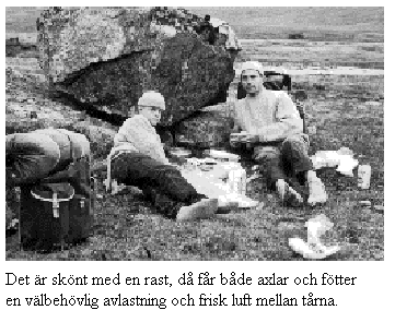
Dinner was ready and the dishes washed, but no boat in sight. We had already started to launch our boat into the lake when I finally noticed that one of the boats on the other side had cast off. After a while it returned to the shore again, and two more men came running down the slope.
We immediately abandoned our attempts with the boat and instead sat down to rest in the lee of the boathouse; the wind was chilly.
After about a quarter of an hour, the boat docked at the pier and it was our turn to start rowing. Across the open water the wind was strong, and I had to pull hard on the oars to avoid drifting too much.
After Teusajaure, the path at first goes through birch forest terrain, first on flat and easy ground, then a short stretch fairly steeply uphill, which gradually turns into barren mountain. On a springy heath you walk further over the watershed between Teusajaure and Akkajaure. To the south you have a magnificent view of the Sarek massif with its western spur, the beautiful Akka.
After a kilometer or so it started sloping downward again, and after many hours we reached the huts at Vakkottavaara. One hut was occupied by an STF party, but in the other there was room for us. There was only a group of 56 people from Osby, one with a movie camera, a 16 mm Paillard. We were invited for coffee and started cooking. In Kebnekaise we had bought a can of kalops and a few packets of mashed potatoes; now it became a real farewell feast. It smelled so good we could hardly contain ourselves until everything was ready.
“I’m not going to complain about the food at home anymore,” said Tomas.
Before bedtime we discussed our hike and took stock. Overall the trip was well planned; we hadn’t brought any unnecessary items. Perhaps I could have left the anoraks at home. The big wool sweater is excellent for such journeys, light and airy. In rainy weather you put on the rain suit; it kept the rain out but some condensation formed on the inside of the jacket. In Saltåluokta we saw a couple who had wind and rain jackets made of some kind of nylon fabric, amazingly light and reportedly completely waterproof, with a slit in the back for ventilation. Unfortunately the price was high – close to 90 kronor – and we were short of money.
There wasn’t much left of what we had brought with us – a bit too much tea and likewise a bit more sugar than was strictly necessary. We didn’t drink as much tea as we had planned. Tomas likes chocolate the most. One reason was also that we went a bit too fast; if Ann-Marie had been with us, we would probably have taken it a bit more slowly.
When we were to travel back, we discovered that there was a certain shortage of money. We had return tickets, but the provisions were gone and new ones had to be obtained. However, time until the train’s departure was short and we didn’t have time to shop, so we had to board the train without food. Somehow the issue had to be resolved, and it happened in the following way.
After a couple of hours, the train made a stop that was supposed to be about 10 minutes, and I rushed off to the post office to withdraw some capital from the Postbank. There were a few people in line and I wouldn’t have had time to queue, so I explained my precarious situation and the friendly Norrlanders let me go ahead in the queue. I withdrew a number of kronor, but there wasn’t enough time to make any purchases; I had to rush back to the station and board the train. The next stop wasn’t for another couple of hours, and then the procedure was repeated. I bought bread, butter, cheese and milk – not only for Tomas and me but also with the young Danish couple in mind with whom we had shared a hut in Kebnekaise. He was studying to become a doctor and his fiancée was already a nurse. Now they too were on their way home to Denmark. With their last coins they had bought a giant reindeer antler; the antler barely fit through the doors and had to be lashed extra securely on the shelf to keep it from falling down.
During the rest of the journey we fraternally shared our provisions with them, and when we parted in Stockholm they got all the leftover food to take with them; they had to travel several more hours.
Back home in Nyköping I had to leave Tomas as collateral with the taxi driver and fetch money from Ann-Marie. People think it doesn’t cost much in the mountains, but that’s an illusion; some goods cost more than in the southern part of the country; the transports up north are long and expensive.